 GDU
GDU
 UUUFLY
 DJI
DJI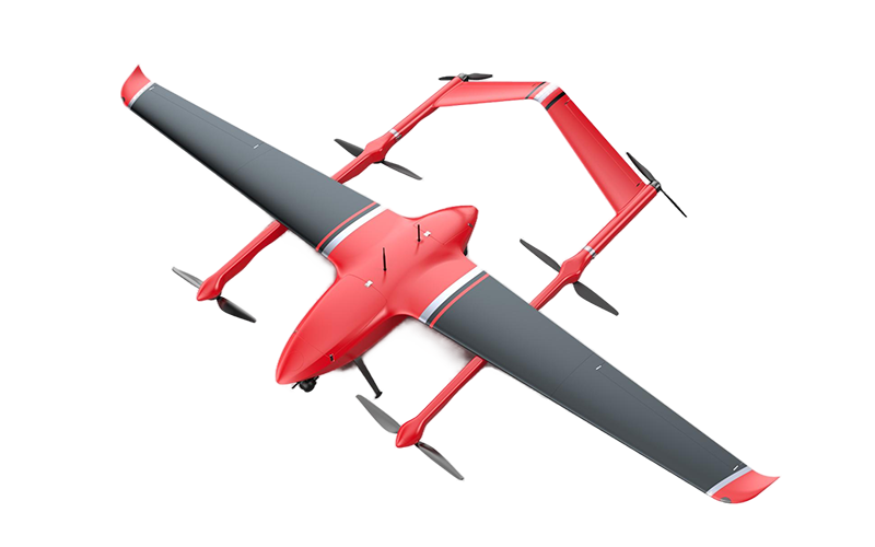 MMC
MMC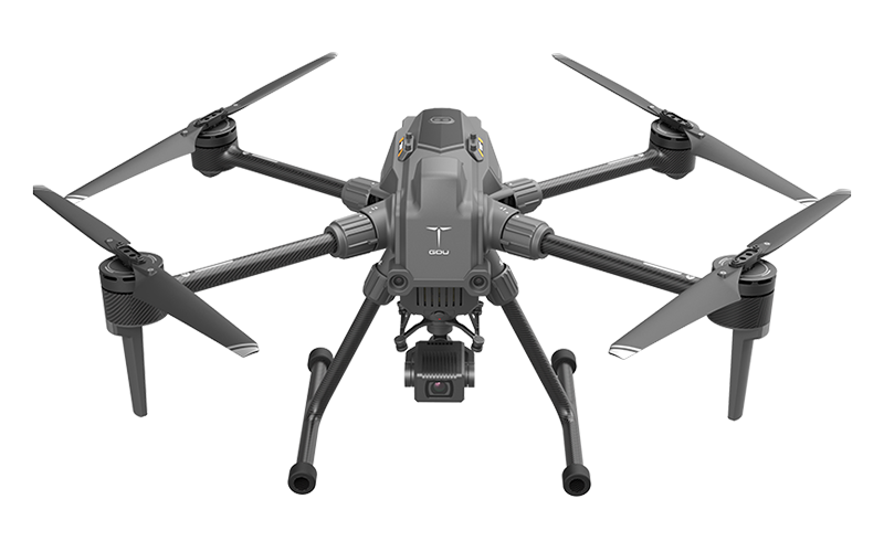 GDU
GDU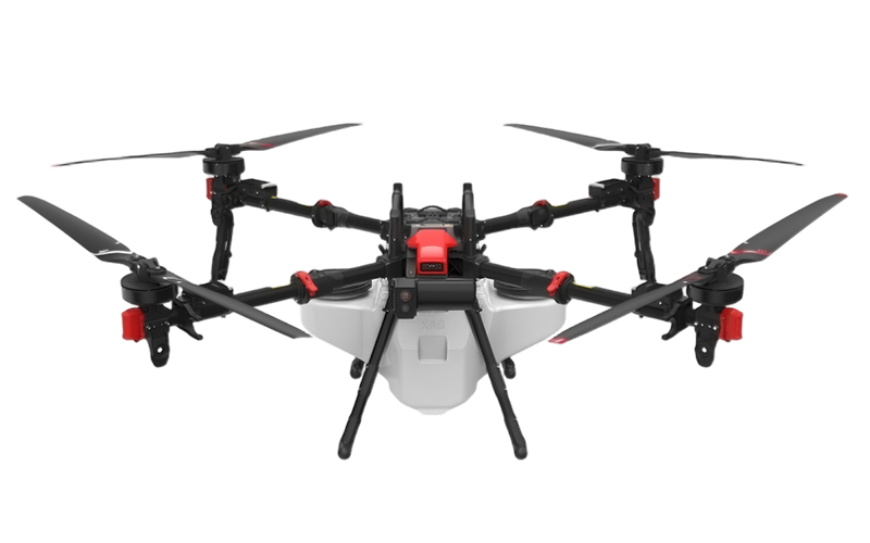 XAG
XAG AOLAN
AOLAN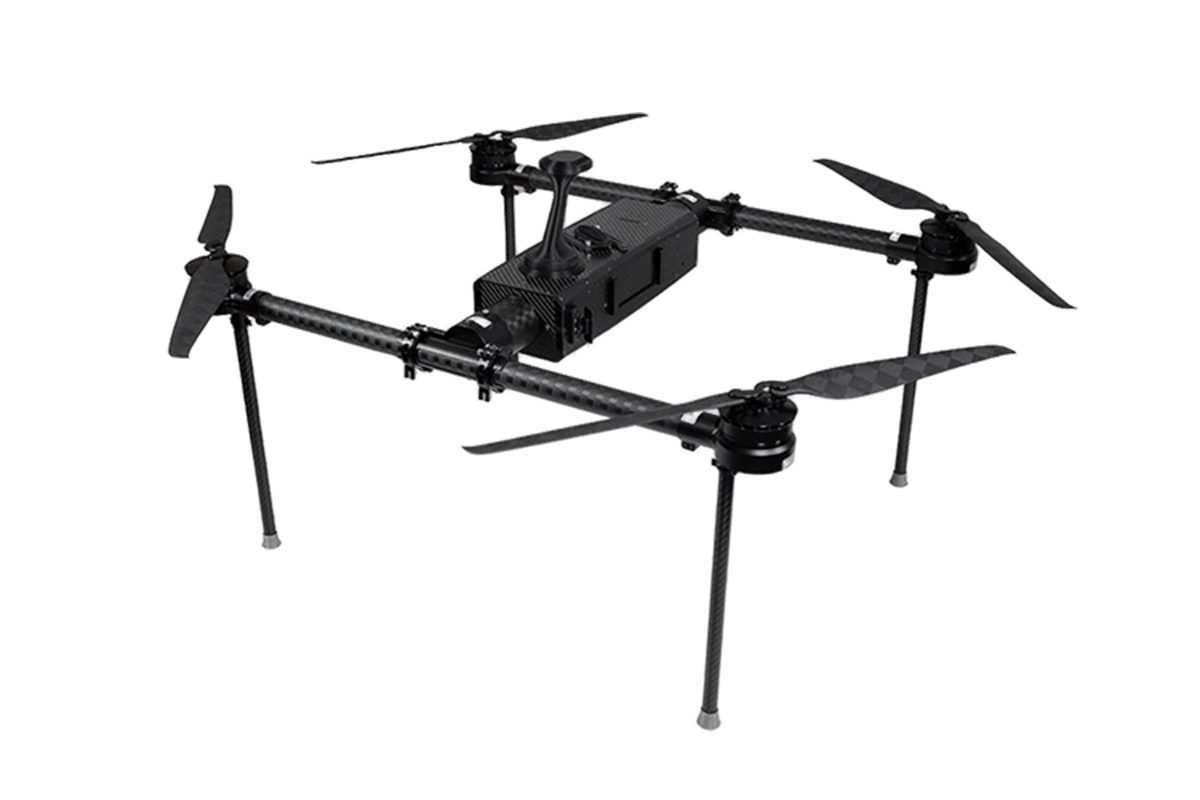 KEEL
KEEL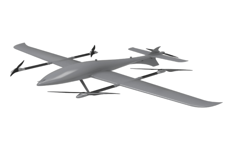 SKY NEXT
UUUFLY · Industrial UAV
Search and Rescue Drones
Locate faster. Coordinate safer. Make every minute count.
Search & Public Safety

Search and Rescue
Drones provide rapid aerial coverage of difficult terrain and transmit live video to command. This significantly reduces search time and directs teams to the precise location.

Surveillance
For public safety, drones deliver real-time situational awareness over large areas—crucial during events and incidents. High-resolution feeds help authorities respond effectively.
Business Value

Wide-Area Coverage
Cover more ground and remove low-altitude blind spots with grid routes and geofences.

Emergency Response
From alert to takeoff in one minute; to scene in three. Low-altitude perspective accelerates decisions.

Responder Safety
Replace manual exposure for high-risk tasks while maintaining situational awareness.
Scenario Highlights
Thermal + Long-Range Zoom
Detect heat signatures at dawn/dusk and confirm identities with 20–56× hybrid zoom. Adjustable palettes and isotherms increase contrast in complex scenes.
Coverage: Fast grid/expanding-square search with geofences.
Coordination: OI sharing and live streaming to command posts.
Evidence: Time-stamped imagery + immutable logs for reports.


Rapid Deployment Kits
Pre-labeled batteries, route templates and secure streaming minimize time-to-detection. Pair with loudspeaker + spotlight for night guidance.
Recommended Products

MMC M11 — Industrial VTOL for SAR
- VTOL fixed‑wing for wide‑area search & long‑leg corridors
- Supports EO/IR gimbals, megaphone/spotlight, RTK mission repeatability
- Designed for emergency response & surveying operations

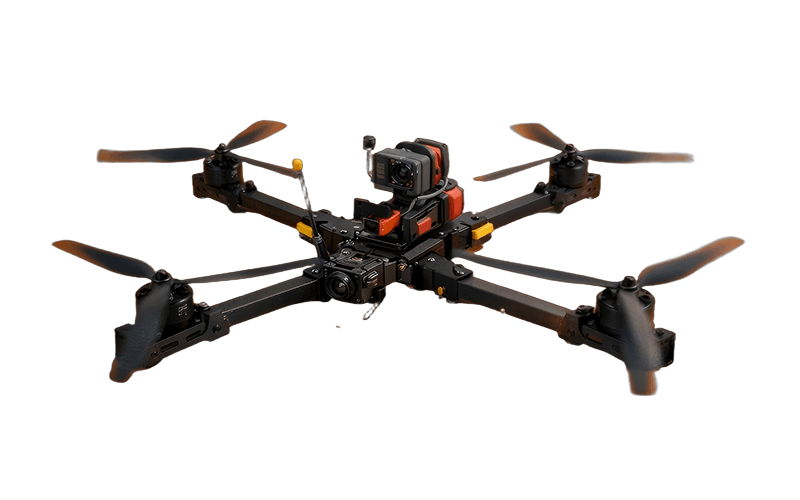
GDU S400E — Utility Multirotor
- Thermal + high‑zoom payload options (ZT30R/HT10RW family)
- Ideal for night search, victim localization, and evidence capture
- Open platform; AI capabilities noted on product line

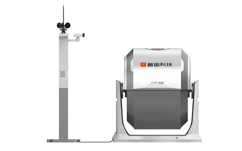
Substation Kit — EO/IR + LiDAR
- Up to ~45–58 min endurance (varies by payload/battery)
- Dual/quad‑sensor EO/IR payload options up to 1280×1024 IR
- 15 km link, modular accessories (speaker/spotlight), docking‑ready
Other Application Scenarios

Coastal & Port Security

Crowd & Incident Response

Dams & Reservoirs

GIS & Mapping

Pipeline & Asset Inspection

Power Line Inspection

Roads & Bridges

Solar & Wind
Surveying & Site Mapping Drones FAQ
U.S. commercial drone operations must follow FAA Part 107 rules, including pilot certification, drone registration, maximum altitude (400 ft AGL), and maintaining visual line-of-sight. Waivers can expand operational permissions for beyond visual line of sight flights.
In many jurisdictions, deliverables used for boundary or property surveys must be signed by a licensed surveyor. For construction progress or volumetrics, a QA process with ground control and check points is typically sufficient.
With RTK/PPK and good survey practice (GCPs, checks, proper overlap), horizontal/vertical accuracies at 2–5 cm are common for mapping-grade outputs. Complex terrain, vegetation, and reflectivity can affect results.
Orthomosaics (GeoTIFF), DSM/DTM, point clouds (LAS/LAZ), textured meshes (OBJ), and stockpile volumetric reports. For inspection, high-res imagery, thermal layers, and annotated defect lists are typical.
Export to widely used formats (GeoTIFF, DXF/DWG, SHP/GeoPackage, LAS/LAZ) and use naming conventions, CRSs, and metadata standards your team already follows. Many teams automate ingestion with scripts or ETL tools.
LET'S GET YOUR PROGRAM STARTED
READY TO BUILD YOUR UAS PROGRAM?
Get a full, personalized system built for your specific needs. Our expert team can assess your situation and recommend the best drone system for your organization.

Talk to an Expert
Plan your Search & Rescue deployment with UUUFLY. We provide hardware, software, training and long-term support.